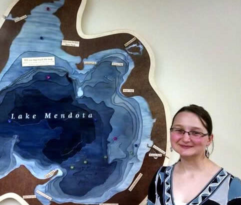
At the “Science Hall After Dark” event Nov 11, I was fortunate to meet an interesting young geographer, Caroline Rose. She’s made a 3D map of Lake Mendota at Madison, Wisconsin for the Wisconsin Hoofers. It’s available for viewing at their space at Memorial Union on campus.
Her portfolio of the project is here: http://cmrrose.github.io/mendota.html . The project was featured on the UW News http://news.wisc.edu/lake-mendota-mapmaker-shows-depth-of-her-appreciation/ .
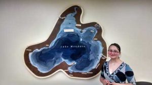 I asked Caroline what makes 3D maps so compelling. “Specifically for my Mendota Map, the 3D form serves a few purposes,” she said, but mainly to “match the aesthetic of the outdoor clubs’ space in a way a touch screen could not (the other meeting room looks like a ski lodge). The artwork contributes character to a brand-new remodeled space [while the] magnetic surface allows users to change the representation to suit their needs by arranging and creating magnets (a Sailing class needs to show something different from a Scuba meeting).”
I agree. Computer screens, paper, and stone radiate meaning, and any maps on that material acquire its underlying meaning. The data layer on top of that map also inherits the material’s “feel” and reflects it as physical metadata.
Rose said her talk for the Maptime Madison series in October had 7 examples of what makes a three-dimensional map so irresistible:
- Form facilitates understanding
- Materials carry meaning
- Using sculptural form to re-frame perceptions of place
- Using the third dimension to represent data
- Inviting interaction
- The tangible experience of making
- Celebrating the beauty of geographic forms in beautiful objects
What so interesting about Rose’s work is how much her experimental technique and craftsmanship mirror early relief modelling in the 1870s. Early modelmakers, like Edwin E. Howell who made many of the relief models in Science Hall, used the new technique of topographic contours to trace cardboard layers for his 3D sculptures. Contours were so difficult for the layman to abstract elevation from, he–like Caroline Rose–wanted to make the topography useful and artistic. What better way than to make it tactile and colorful?
In the same way, Rose was experimenting with new laser cutters and software programs to transfer the cartography to the materials. In 1892, Howell was experimenting with a new machine called a contour saw to cut contours in thick cardboard without knives or shredding caused by early band saws.
Rose also experimented with magnetic finishes on her model, an interesting and earthy touch. When Howell made his relief models, many of them contained fine sand to add texture to desert terrain. Howell also used durable artists’ paints so that his relief models could be touched and used for their purpose: understanding the map’s data while geovisualizing its beauty.
Keep on going, Caroline! You can catch up with her at NACIS or on campus this year.